Hi folks!
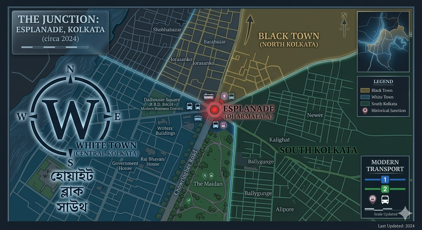
In my various posts, I’ve been talking about the culture, architecture, and lifestyle of Kolkata. This might have given you the impression of a uniformly charming and quirky city. However, that is far from the case. Like any historical city, Kolkata has layers in its urban evolution. Driven by racial segregation and class aspiration, colonial Kolkata was split along geographical lines that also served as sociocultural lines. Today, let’s look into that and understand how the city’s division into “white town”, “black town”, and “south” has shaped its character.
When the British East India Company set up their trading post and, later, their headquarters in the newborn city of Kolkata, there were already Bengali communities living in the three villages which they joined together. As the Britishers picked areas like Park Street and Esplanade (and later, Fort William) in central Calcutta for their settlement, the native population was relegated to Sutanuti and its neighbouring areas, leading to the creation of “white town” and “black town”.
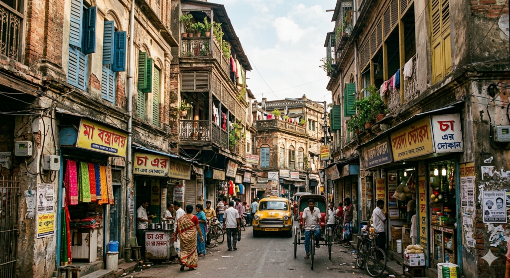
The people of the villages that were bought by the British had been pursuing traditional rural occupations for generations, though the advent of European traders had started creating new types of jobs too. With the establishment of the city, some of the traditional occupations died out whereas others were created to build, maintain, and expand the city. At this point, most of the locals living in “black town” worked as fishermen, potters, labourers, and other menial workers, living in poverty and squalor. Even most of those who moved from other villages in search of employment in the city could get only these types of jobs and had to live in the kind of humble dwellings they had been used to in their villages.
There was a small section of the population that was socioeconomically much better off from the bulk of the native population of black town, though. They were newcomers to the city, drawn to it by the prospect of wealth through employment with the East India Company. These were educated men who often took up work as scribes, clerks, agents, etc. for the British. Some of them rose from ordinary levels of society, while some were well-to-do descendants from prosperous landed families of the districts. They became some of the wealthiest native families living in black town and built their mansions all over the area that we today call North Calcutta.
For the most part, black town—which constituted 80% of the available land space in the new city—was a chaotic mass of humanity. There was no urban planning to speak of; houses piled on top of each other, shops encroaching onto residential areas, narrow lanes and alleys winding through maze-like blocks of houses and markets, no proper thoroughfares or wide roads, and the poorest beggar rubbing shoulders with the richest British agent, geographically speaking. Even today, North Calcutta possesses many of these same characteristics, especially the chaos of unplanned urban development and narrow roads.
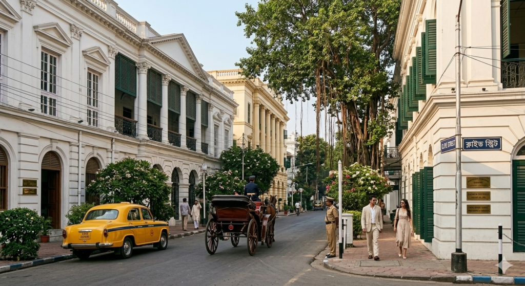
White town was in sharp contrast to this aesthetically as well as economically. The British had settled down in the central region of the new city, around the Park Street and Esplanade areas, after Siraj-ud-Daulah’s attack on Fort William had forced them to move away from Sutanuti. The new Fort William coming up in the Gobindapur area now became the centre of their habitation. However, it wasn’t big enough to accommodate the growing population of white-skinned people flocking to Kolkata looking to make their fortune.
Soon, thanks to a land grant by the Mughal Emperor of the time, Farrukhsiyar, the East India Company added 38 new villages to the rapidly expanding city. This included localities like Chowringhee and Birji, into which white town began to expand. These places had well-built wide roads, large colonial mansions, parks, and gardens along the lines of those found in London. At the heart of it was the Maidan, created by clearing away a large portion of forest land, which was meant to echo London’s Hyde Park.
Although white and black towns were strictly segregated for decades, thanks to the racist beliefs and practices of the colonial British, things began to change in the 19th century. By the end of that century, the barriers between the two sections of the city had almost disappeared as a growing class of western-educated, confident, and wealthy Bengalis started moving into areas originally within white town, especially Theatre Road and its vicinity. This new community of upper-class Bengalis was rooted in their own culture but was also more progressive and ambitious due to the imbibing of western influences through their education.
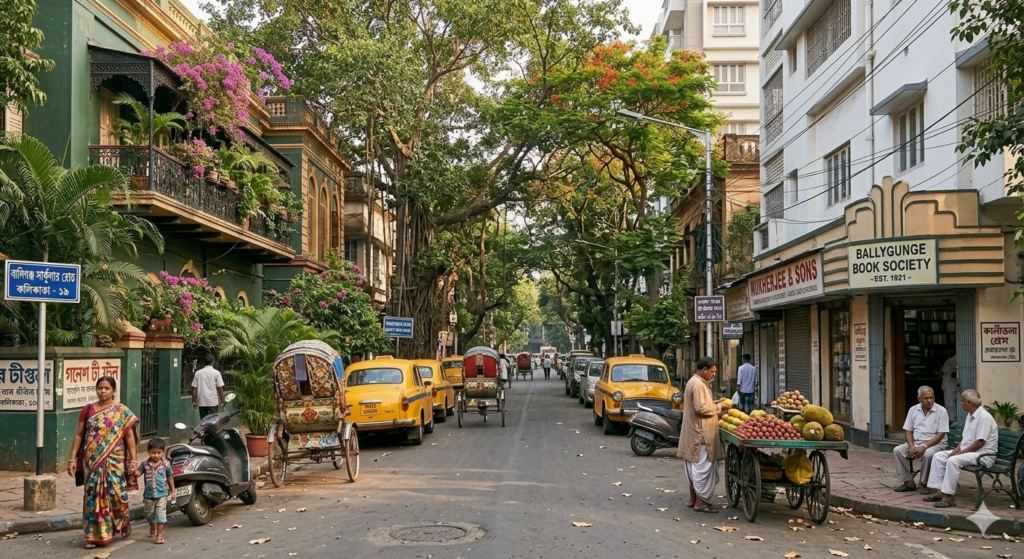
As the 20th century dawned, these people continued to move further south, into territories that were still largely forested and semi-rural. This shift led to increased urbanisation in what became “south town”. In 1929, the Bengali population of these areas appealed to the Calcutta Improvement Trust for work in around the Dhakuria Lake and Ballygunge, leading to a very different kind of urban development story in South Calcutta. These areas had better roads than the northern part of the city, architecture that blended multiple influences, better public amenities, and much more systematic planning.
The different stages of Kolkata’s urban evolution have left the city with distinct geographical regions that have very different “vibes”. The differences—which weren’t just architectural or infrastructural—are still visible today. They are manifested in the way people talk, eat, or live, and in their preferred cultural pursuits, pastimes, and houses. The partition and mass migrations of the mid and late 20th century as well as the continued expansion in the late 20th and early 21st centuries has added further layers to the city’s demographic, geographical, and cultural landscape. But those are stories for a different post!
#AtoZChallenge
#BlogchatterA2Z
#Kolkata
#cityofkaali
#northkolkatavssouthkolkata
This post is a part of Blogchatter A2Z Challenge 2026

Leave a Reply